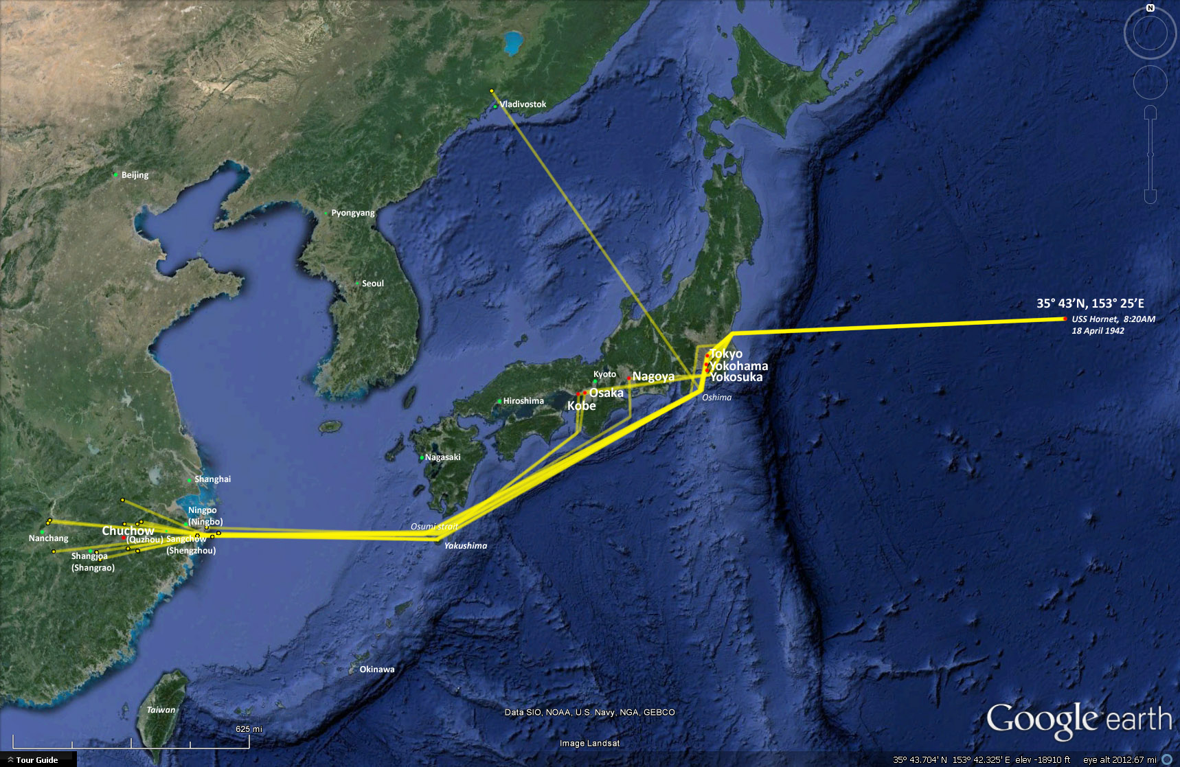
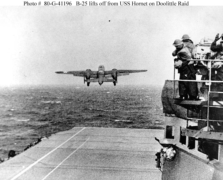
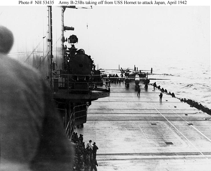
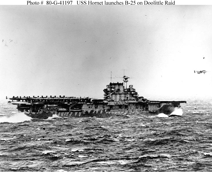
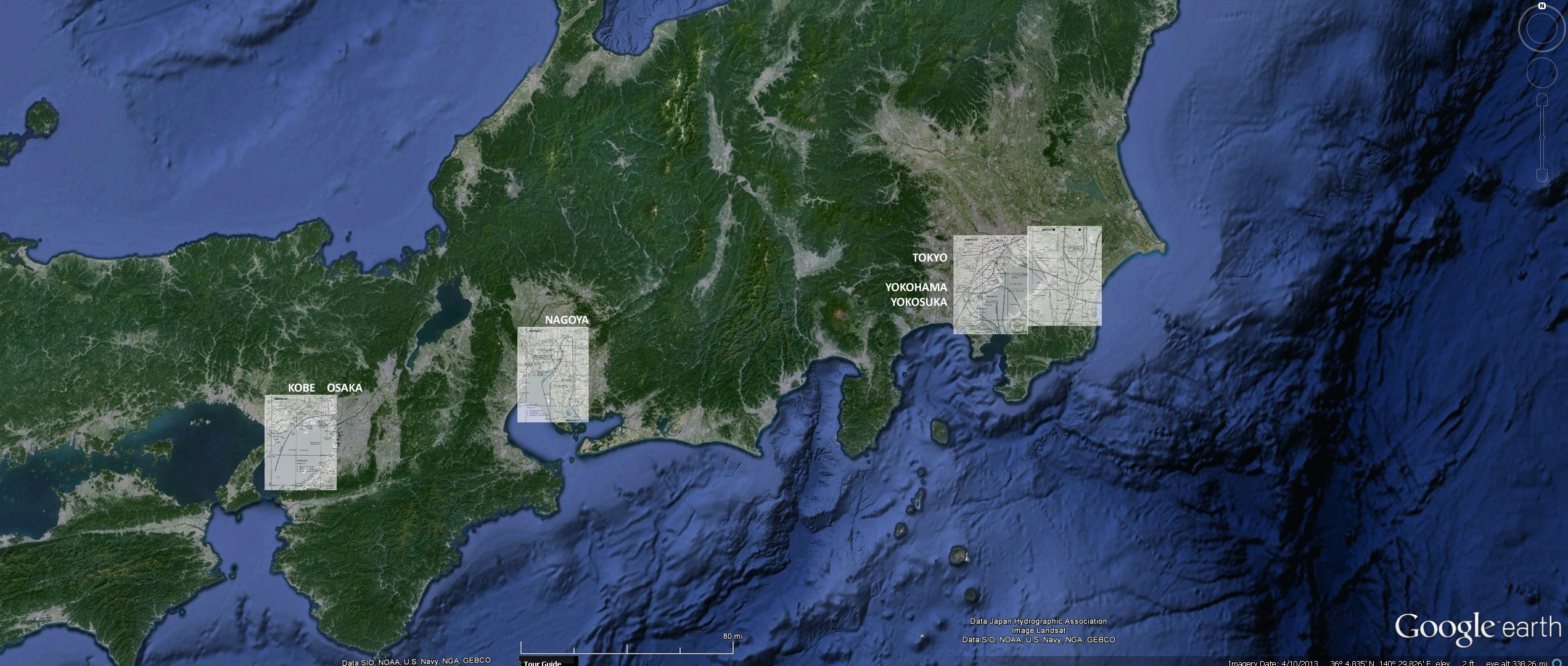
Doolittle Raid Flight Paths on Google Earth

 On the morning of 18 April 1942, sixteen B-25B Mitchell bombers took off the USS Hornet on a daring and courageous mission to bomb
 industrial targets in Japan.  Information on the flight paths from the Doolittle After Action Report were placed onto Google Earth maps,
 providing another perspective to the accomplishment of the historic mission.

 Here is the path of the sixteen aircraft overlaid on Google Earth:

 click on image for a larger version. 


On the morning of 18 April 1942, takeoff at 35� 43'N, 153� 25'E:
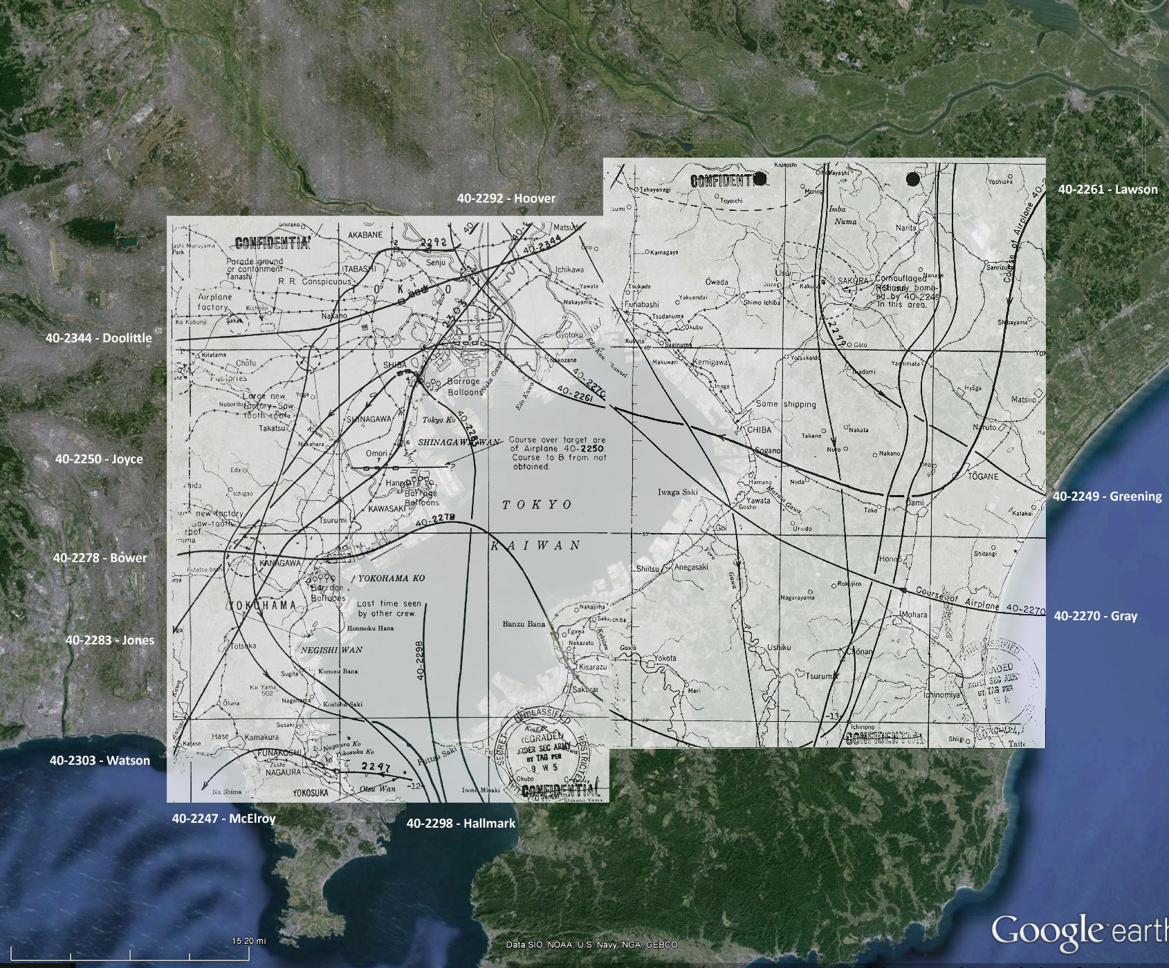
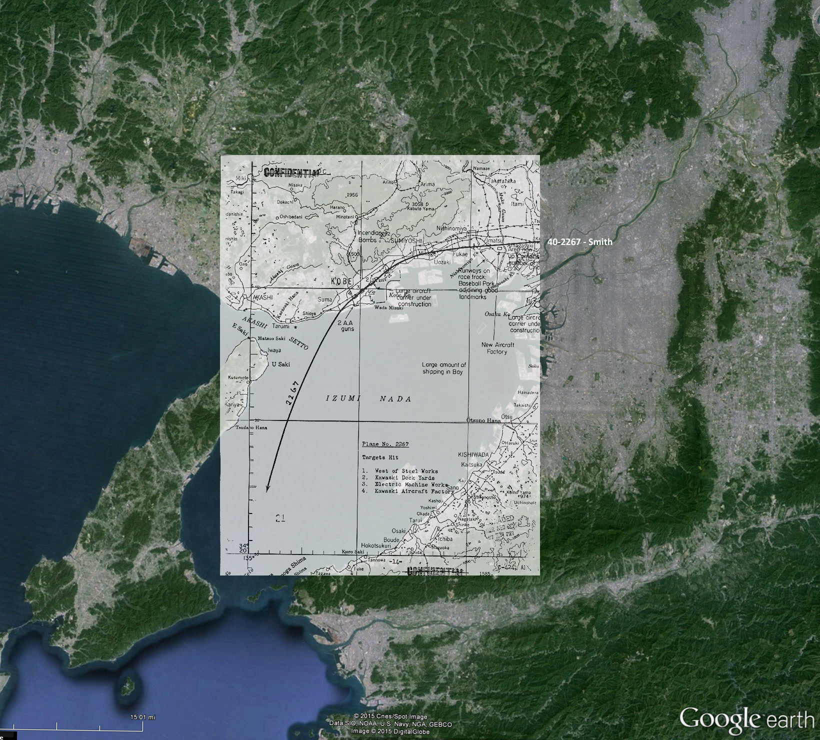
.


 The navigational coordinates of Gen. Doolittle's A/C 40-2344 on Google Earth:

 click on image for a larger version. 

 Bombing sites in Japan (with bombing flight path maps):

 click on image for a larger version. 

 Tokyo area bombing flight path:

 click on image for a larger version. 

 Nagoya area bombing flight path:

 click on image for a larger version.      

 Kobe area bombing flight path:

 click on image for a larger version

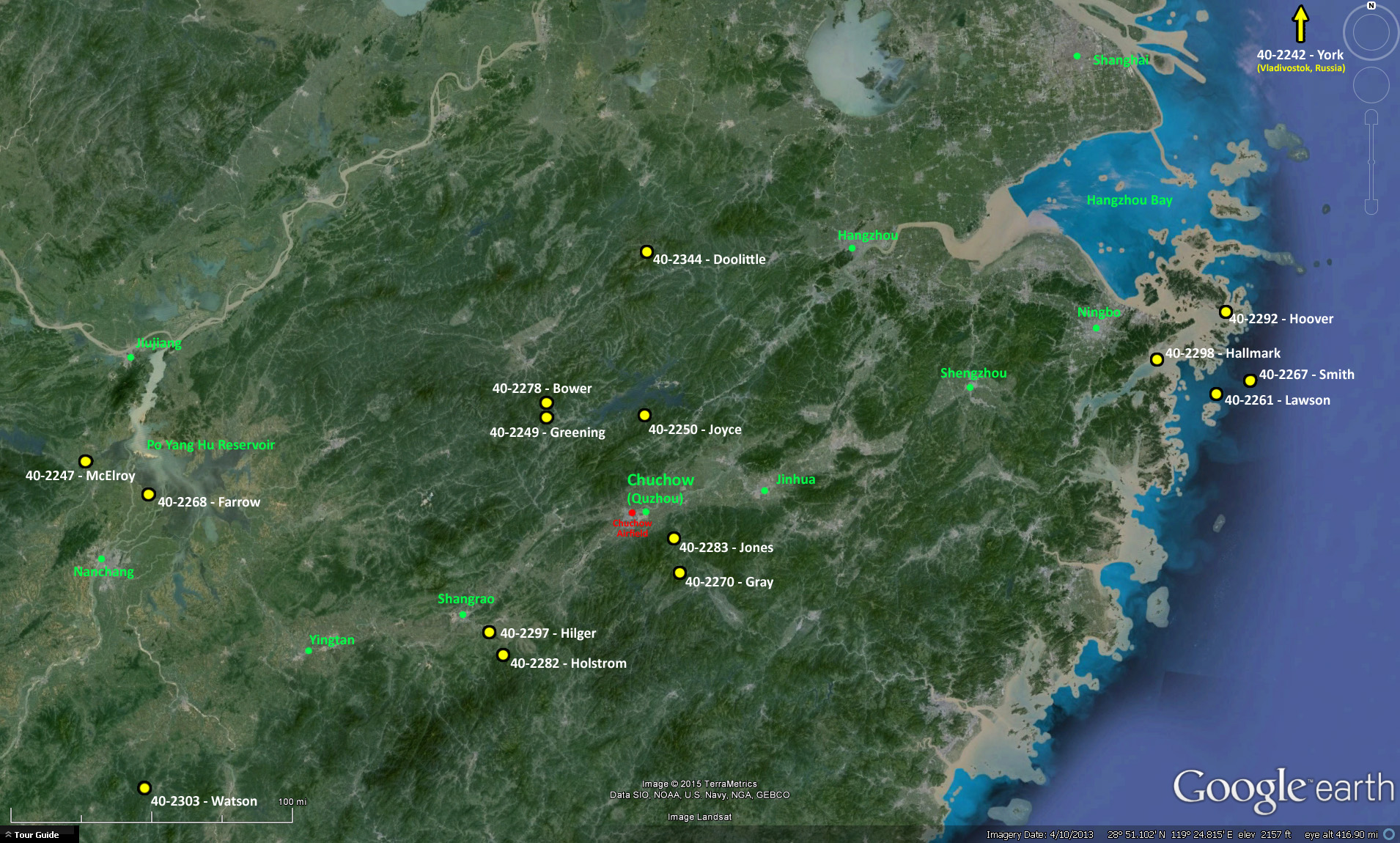
 Locations of aircraft reaching China:    (Aircraft reaching China were abandoned in flight or landed on the coast.)

 
click on image for a larger version.                 

 A comparison of their flight path when mapped over USA:

  over 2100 miles, 13 hours


 LINKS

 Information on the Doolittle Raid mission was obtained from the report available here:
 https://www.ibiblio.org/hyperwar/AAF/rep/Doolittle/Report.html